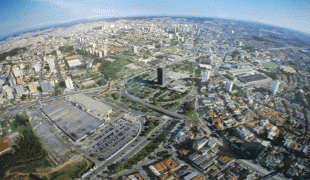
São Bernardo do Campo (São Bernardo do Campo)
 |
 |
It is part of the Metropolitan Region of São Paulo. The population is 844,483 (2020 est.) in an area of 409.51 km2.
The city was founded by João Ramalho in 1553 and was known as Vila de Santo André da Borda do Campo de Piratininga, soon transferred to another nearby place, safer from hostile tribes. It is, however, historically perceived as the first Brazilian settlement built away from the sea. The original settlement was then resettled as São Bernardo, became a parish in 1812 and became a municipality in 1890. In 1938, it became a part of the Santo André district only to be separated again in 1945, as the aftermath of an action from a group of entrepreneurs led by Wallace Cochrane Simonsen, who was eventually appointed as the first mayor of the newborn municipality.
The area where São Bernardo do Campo, Santo André, São Caetano do Sul, and Diadema are located was once a farm owned by Benedictine monks, who owned enslaved Africans. By the second half of the 19th century, European immigrants started to come to the area, mainly from Italy. Italians settled in cottages in the rural area of São Bernardo do Campo that were called colônias. By the beginning of the 20th century, Japanese immigrants arrived, most of them going to the neighborhood called Cooperativa.
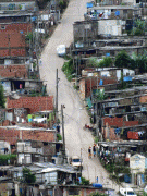
Industry, particularly metal works, thrived in the city during the 1960s, when São Bernardo do Campo became known as Brazil's Automobile Capital (Portuguese: a Capital do Automóvel). Many of these plants have since relocated to other regions but the automobile industry remains a vital part of the history of São Bernardo do Campo. The city is also known for its furniture industry developed by Italian immigrants, who helped São Bernardo do Campo become a high-tech industrial hub.
Industrialization also attracted migrants from the Brazilian Northeastern region in the 1960s. Among them was the family of Luiz Inácio Lula da Silva, who grew up in the region. The future president of Brazil worked in automobile factories in São Bernardo do Campo in the 1970s, becoming a union and anti-military dictatorship figure.
São Bernardo also contributed to the development of Brazilian cinema, mainly during the 1950s and 1960s, thanks to the Vera Cruz studios, which produced a great number of movies and revealed many notable actors. This is also the birthplace of the football player Anderson Luís de Souza, better known as Deco.
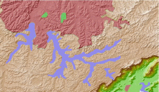
Map - São Bernardo do Campo (São Bernardo do Campo)
Map


Country - Brazil


Currency / Language
| ISO | Currency | Symbol | Significant figures |
|---|---|---|---|
| BRL | Brazilian real | R$ | 2 |
| ISO | Language |
|---|---|
| EN | English language |
| FR | French language |
| PT | Portuguese language |
| ES | Spanish language |